UK weather forecast: Britain to bake in 22C sun blast IN DAYS – before storms hit nation
UK Weather: Carol Kirkwood forecasts high temperatures
We use your sign-up to provide content in ways you’ve consented to and to improve our understanding of you. This may include adverts from us and 3rd parties based on our understanding. You can unsubscribe at any time. More info
After a rainy Bank Holiday weekend, Britons will enjoy a drier week, with occasional sunshine bursting through the clouds. Through to Friday, the most rainfall expected in 38mm in Scotland, with most of the country seeing at least some showers until the weekend.

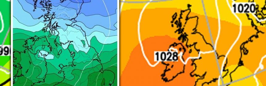
In maps from WXCharts, the remainder of Tuesday sees a split between the north and south of Britain and Ireland.
With minor showers, less than 1mm an hour, featuring across England and Wales throughout much of the day, midnight on Wednesday sees the heaviest spells of the day localised along the north west.
At this time, a maximum of 3mm of rainfall an hour features over the Hebrides and north west Scotland.
This spell of rain then pushes southeastwards into England and Wales, but dissipates by 6am on Wednesday with a maximum of 2mm of rain over Manchester.
A bizarre formation of rain then features along the south east coast of England by 3pm, where less than 1mm an hour clings along the edges of Britain.
This then dissipates by 9pm, leaving Wednesday night and Thursday morning mostly dry for Britons.


Friday sees a band of rain move across the UK, starting at midnight over Belfast and the Isle of Man.
The worst of the weather then features over Wales and the Midlands by midday on Friday, with 3mm of rainfall expected, before clearing into Europe by 3am on Saturday.
In total, by midnight on Saturday WXCharts holds that a total of 38mm of rain will have fallen over the Hebrides throughout the next four days, while Essex sees 15mm, Belfast sees 12mm, Manchester sees 8mm and Southampton sees 4mm.
Temperatures also vary between north and south, with 3pm on Wednesday seeing a cool average of 7C to 10C in Scotland and Newcastle, and a balmier 14C to 16C in London and Wales.
Throughout the week, the mercury is set to climb up across the county but with the split between north and south remaining.
At 3pm on Thursday, temperatures are expected to reach 17C in England and Wales, while the mercury in Belfast and Carlisle also climbs to 13C.


Met Office forecaster Simon Partridge said: “This week is a funny old one. There’s a far bit of rain and cloud around as well as sunny spells, with many areas gradually warming up until Thursday, which should be the warmest day.
“Between Monday and Wednesday temperatures will sit in the high teens and low 20s in Wales and central and southern parts of the England, while eastern Scotland could reach 19C.
But in parts of Northern Ireland, northern England and Scotland there will be cloud and some scattered showers.
“Thursday will see high teens quite widely across the country, parts of the South East will rise as high as 21C, with an outside chance of 22C in areas where there is more sunshine.”

Jo Farrow, Netweather.tv forecaster, said: “A few parts of the West Country could see slow-moving showers with a sharp downpour by this afternoon.
“The same for inland Wales. Where the convection is set off there will also be bright or sunny spells alongside which will aid the temperatures for Cardiff, Bath and Reading to reach 17 or 18C.
“Orkney had a sunny Bank Holiday Monday and a fine start this morning but there is a series of fronts heading in from the Atlantic.
“These bring more cloud and patchy rain today over Northern Ireland, Scotland (mainly for the west and north) and NW England as the day goes on with more persistent rain for western Scotland this evening.”

“Overnight the frontal bands push rain across the UK, it’s rather raggedy but will reach East Anglia and SE England by morning. NE Scotland and SW England miss most of it but even areas in the middle will only see showery outbreaks on Wednesday morning.
“With a bit of sunshine and temperature lift, some of the showers along the spine of Britain will get going by lunchtime but pressure is rising out to the west, so the weather becomes more settled here and dry.
“The focus of the showers moves to eastern England on Wednesday afternoon with the risk of an isolated thunderstorm. It’s a bit of a messy picture with a fair amount of cloud. Afternoon temperatures will be 13 to 19C, maybe up to 21C in any sunnier spots. Feeling a bit cooler though for NW Britain with a moderate west or NW breeze for the coasts and hills.
“The Azores high is nosing up from the southwest by Thursday bringing fine, warmer weather but frontal bands continue to snake over more northern parts of the UK. That brings more cloud, outbreaks of rain, mostly in the far northwest and more of a breeze.
“Thursday will be warm for much of England with temperatures widely in the mid to high teens, even low 20C.”
Source: Read Full Article