La Palma volcano: New satellite images show violent eruption from space as lava flows across island
New satellite images show La Palma’s erupting volcano from space, as lava continues to flow across the island.
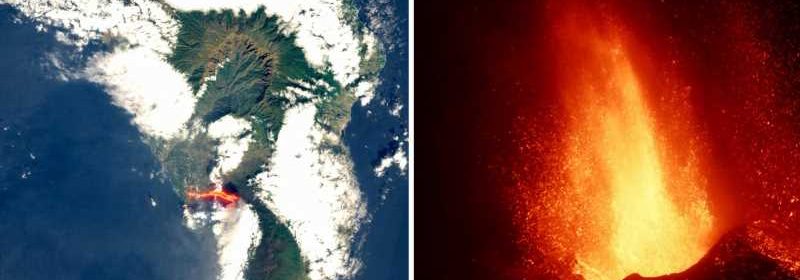
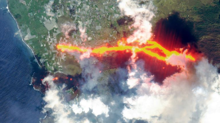
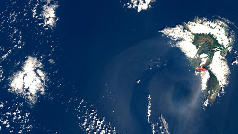
The pictures taken by the European Union Copernicus Sentinel-2 satellite on Sunday, show the flow of lava from the Cumbre Vieja volcano on the Spanish island.

From today, members of the Spanish Navy are to due to help clean up volcanic ash that is covering large parts of the island and has previously caused the airport to close.
Airline Binter Canarias said its flights have returned to normal, although there may be some operational delays, so urged customers to check the status of their flights.
The island’s council has announced that access through the town of Tazacorte, which has a population of around 4,600 people, will not be allowed due to the volcano’s ongoing activity.
Around 200 members of the military personnel remain deployed on the island, along with special technical equipment for detection, identification and environmental sampling.
More than 1,000 buildings have been destroyed and around 6,000 people have been evacuated from their homes since the eruption began on 19 September.
By 28 September, the 6km lava flow had reached the Atlantic Ocean, spilling off of the island’s west coast.
In recent days, part of the volcanic cone formed during the eruption collapsed, opening up new paths for the lava.
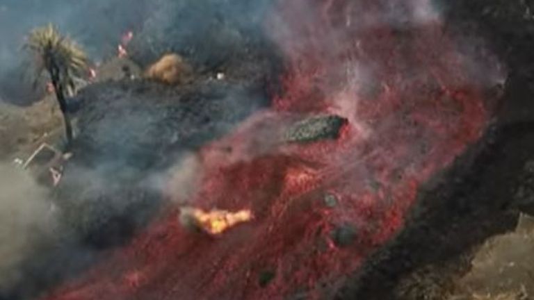
Drone images taken over the weekend showed massive blocks of red-hot magma flowing down the side of the volcano, with some the size of three-storey buildings.
The lava flow, which reached temperatures of up to 1,240C (2,264F), destroyed the last few remaining buildings in the village of Todoque, the Canary Islands Volcanology Institute said on Sunday.
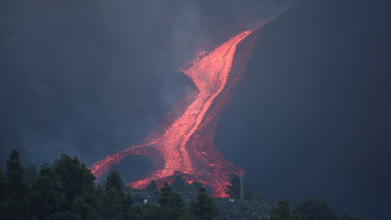
Authorities monitored the new stream – with anything in its path being consumed, including farms, swimming pools and industrial buildings.
The Spanish National Geological Institute said there were 21 seismic movements, with the largest measuring 3.8, on Sunday.
It added that they caused the ground to shake in the regions of Villa de Mazo, Fuencaliente and El Paso.
La Palma is part of Spain’s Canary Islands, an Atlantic Ocean archipelago off northwest Africa, whose economy depends on the cultivation of canary plantain and tourism.
Source: Read Full Article