Ida bringing tornado, rain threats as it moves inland
Tropical Storm Ida moves inland, carries tornado, heavy rainfall threat
Fox News senior meteorologist Janice Dean provides storm update.

Catastrophic, historic Ida has left a path of destruction as it made landfall yesterday as a Category 4 hurricane near Port Fourchon, Louisiana.
The National Hurricane Center says landfall occurred around 11:55 a.m. CT with maximum sustained winds of 150 mph.
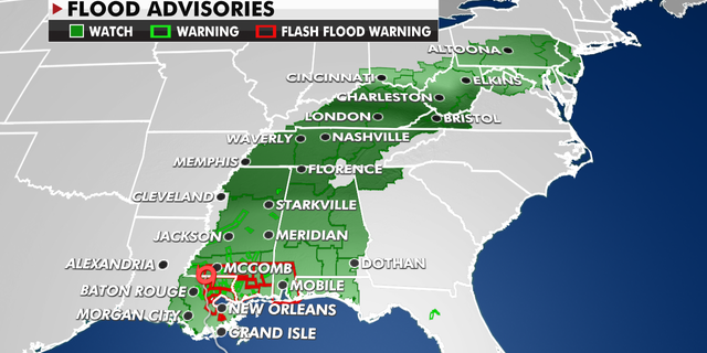
Flood advisories currently in effect.
(Fox News)
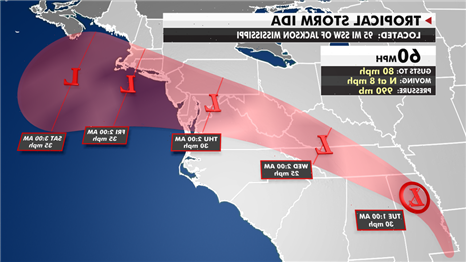
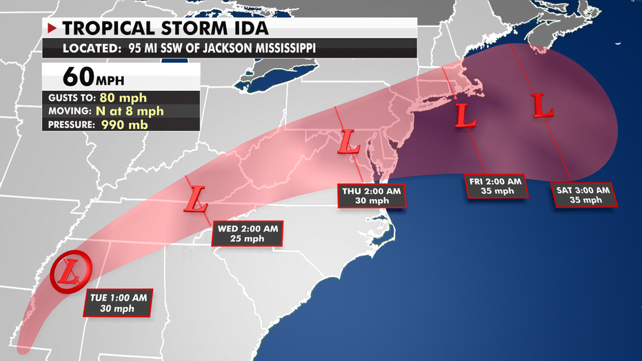
Ida has weakened into a tropical storm and will continue to lose some of its strength. However, the next stage of this system’s impact will bring flooding rainfall for millions of people along its path through Thursday.
IDA’S IMPACT ON LOUISIANA IS ‘UNPRECEDENTED,’ CAJUN NAVY RELIEF PRESIDENT SAYS
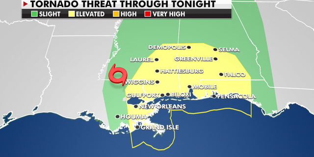
These areas are at risk of tornados Monday.
(Fox News)
Strong winds will remain possible through the day, which could knock out power.
The tornado risk will also continue to the east of the center of circulation.
CLICK HERE TO GET THE FOX NEWS APP
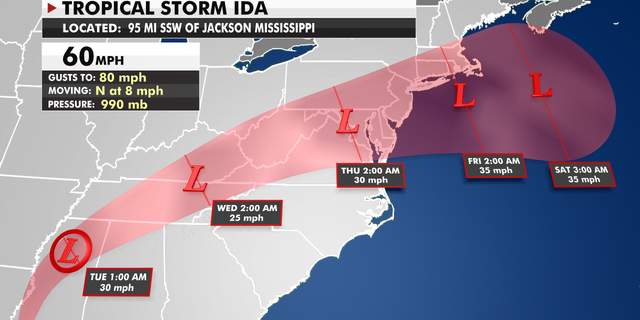
The current track of Tropical Storm Ida.
(Fox News)
Heavy rain is going to be the biggest concern as the remnants of Ida move into the Mid-South, the Mid-Atlantic and the Northeast.
Three to 6 inches of rain is expected along Ida’s path — including through southern New England where the ground is saturated from Henri a week ago.
Source: Read Full Article