Denver weather: Heavy rain, flood watch effective through midnight
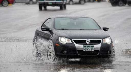
Ample rain falling as afternoon thunderstorms roll over metro Denver and Colorado’s Front Range urban corridor Monday may lead to flooding, according to the National Weather Service.
Weather service officials have issued a flood watch, effective through midnight, warning storms could cause flooding across eastern Colorado, including Denver, the mountain foothills, high plains, and Colorado Springs. Recent rain has saturated much of the state to the point soils cannot retain water. Flooding risks were highest on the plains east of Interstate 25 encompassing the Palmer Divide between Denver and Colorado Springs along with Elbert, Lincoln, Weld, and El Paso counties. Meteorologists estimated the likelihood of rain at 80%.

The high temperature in Denver will be 69 degrees, decreasing to 50 degrees Monday night, forecasters said.
Scattered rain and thunderstorms Monday morning as clouds enveloped parts of the Front Range were expected to multiply in the afternoon. Some strong storms may produce hail up to an inch in diameter along with very heavy rain.
Weather forecasters anticipated an especially high potential for flooding problems on the burn scars in the northern Front Range mountains where 2020 fires ravaged vegetation. Rainfall dropping up to an inch of water in half an hour or less could set off mudslides. On Monday night, storms are expected to diminish.
Source: Read Full Article