Colorado flood warnings: More issued this year than any year in history
It’s no secret that there have been multiple occasions where flooding has wreaked havoc across Colorado over the years. This year, that especially rings true. Although the year is not over yet, the number of flash flood warnings that have been issued across Colorado has already shattered the previous record set in 2013.
So far in 2021, there have been 282 flash flood warnings issued across the state. The 10-year average is just over 100 flash flood warnings issued annually, so this year has more than doubled and is close to tripling the “normal” number statewide. In 2012, a year with a rather extreme drought, there were only 62 flash flood warnings issued across the state. Inversely, the following year, 2013, saw a then-record 176 warnings.

The National Weather Service is responsible for issuing flash flood warnings when areas are about to or are experiencing impactful weather. Flash flood warnings are issued to alert the public that a flash flood is imminent or occurring in the warned area. A flash flood is a sudden, violent flood after heavy rain, or occasionally after a dam break. Rainfall intensity and duration, topography, soil conditions and ground cover contribute to flash flooding.
“Burn scars have definitely increased the number of watches/warnings issued, no question,” Thomas Renwick of the the NWS in Grand Junction said.
Wildfires, which are becoming more numerous and intense across the west amid a warming climate, and the effects of heavy, monsoon rains, lead to big flooding events like we’ve seen this year. This year was a perfect setup for flash flooding. We were coming off of a year with extreme drought plaguing the state, we just had our most active wildfire season ever and we saw the monsoon season actually impact us this year for the first time in years. This combination was the perfect recipe for flash flooding.

Western Colorado and the NWS in Grand Junction
Flash flood warnings normally pop up around burn scar areas but they also can come from slot canyons and converging creeks and rivers. The National Weather Service in Grand Junction forecasts for most of western Colorado and eastern Utah. In western Colorado, the Lake Christine, Pine Gulch, Pack Creek, and the Grizzly Creek burn scars are some of the areas that have faced flooding issues recently. Especially the Grizzy Creek burn scar in Glenwood Canyon.

There were a notable amount of flash flood warnings issued in July by the weather service in Grand Junction. This was when multiple surges of monsoon moisture pushed in and caused numerous mudslides and debris flows to cover the interstates and highways.
“The amount of rain that may cause flash flooding in burn scars is MUCH less than over an area that doesn’t have a burn scar,” Renwick said. “Thus, the increased amount of warnings this year.”
The 82 flash flood warnings issued out of Grand Junction so far this year are the most ever issued in a calendar year by that office. Most notable, July 2021 produced more flash flood warnings than any full year since 1986. The 10-year average (2011-2020) number of flash flood warnings that are issued by the weather service in Grand Junction comes out to be near 23 warnings per year. The forecast offices have nearly quadrupled the normal number of flood warnings they issued this year compared to what is normal.
Southeast Colorado and the NWS in Pueblo
Over the years, the National Weather Service in Pueblo continually issues more flash flood warnings than any forecast office across the state. Over the past decade, the Pueblo office issued an average of about 46 flash flood warnings per year. This year, they have nearly tripled that number, with 125 flash flood warnings issued across southeast Colorado.

Many burn scars lay within the forecast zone of the Pueblo forecast office so it’s no surprise that they continually issue the most flash flood warnings. On top of that, the headwaters of many rivers begin in this area of Colorado and spring snowmelt can occur rapidly here leading to issues with flash flooding. Before this year, 2014 held the title for the year with the most flash flood warnings issued in this region with a total of 76 warnings. Back in 2011, the National Weather Service in Pueblo only issued 19 flash flood warnings.
Northeast Colorado and the NWS in Boulder
Thanks to burns scars and wild weather events occurring, flash flooding has hit northeast Colorado many times. The Cameron Peak and East Troublesome burn scars have been creating flood concerns for months now and thanks to the heavy rains we’ve seen this year, they have produced catastrophic damage and even claimed lives.

Northeast Colorado is no stranger to flash floods. The forecast office in Boulder issues about 27 flash flood warnings per year since 2011, but this year it had issued 80 flash flood warnings through August.
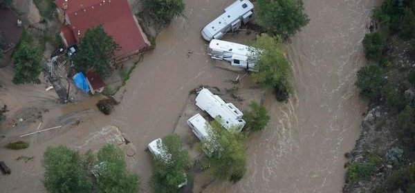
In a similar setup, monsoon rains and slow-moving thunderstorms have led to many inches of rain falling in some areas. There was a year, however, with more flash flood warnings than this one for the National Weather Service’s Boulder office. The devasting floods in September 2013 led to that year having more flooding warnings than 2021. This year trails 2013 by two flash flood warnings, and though it’s not a complete guarantee, there is the possibility of having more flash flooding concerns in the coming weeks as we are still in monsoon season.
Overall, flash flooding occurs in Colorado every single year. Some years there is not much flooding, but in other years, an entire season could be remembered by the flooding that happened. There is not an official “flash flood season” in Colorado, but if there was, it would probably land between May and September, so we still have a couple of weeks of flash flooding potential. Flash flooding doesn’t normally occur in the wintertime in Colorado.
Source: Read Full Article