Brits scoff at weather experts who claim UK summer has been HOTTER and DRIER than usual after torrential storms
BRITS have scoffed at weather experts who claim this summer has been hotter and drier than average.
A Met Office meteorologist said that despite the periods of heavy rainfall and thunderstorms the weather across the country has been warmer than usual.


Becky Mitchell, of the Met Office, confirmed yesterday that this summer has been "warmer and drier than average."
But despite this, some Brits believe the summer was a complete washout, reports the Daily Star.
“Are they having a laugh? This has been the most typically British summer since records began," one person wrote on Twitter.
“The Met Office have lost the plot," another wrote.
"Take a look out of the window…. It's p***** down."
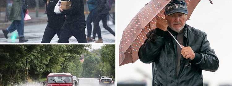
The past month has seen Brits hit with floods and battered by thunderstorms.
And this, according to meteorologists, may have caused people to forget about the warm weather that came before it.
"It's not been wetter on average but we've seen a lot of reports on the news about the flooding," Ms Mitchell explained.
"That's why it may feel like a bad summer, with not much warmth or sunshine."
Last month temperatures exceeded 30C across the UK with Public Health England issuing heat warnings urging people to keep cool in the boiling heat.


Ms Mitchell said the only exception of the drier and warmer than average weather has been the southeast of England which has already had 111% of its average rainfall for the summer.
“There was a heatwave during the middle part of July," she said.
"The end of that heatwave triggered a lot of thunderstorms and heavy and intense rain, which is what brought some of those flooding incidents across parts of the southeast."
She went on to say that the high amount of rain in the short period caused "localised flooding events" but denied it was a "wet period".
In recent weeks, London was repeatedly hit with intense flooding with some locals forced to abandon their cars in floodwater.
Last week 100 patients were evacuated from a hospital after an entire block suffered a power blackout amid heavy flooding.
A video posted online showed Pudding Mill Lane DLR station near Stratford underwater after a period of heavy rainfall.
Meanwhile, a 500-mile-wide French flare is set to bring a scorching three-day heatwave to the UK next week.


The mercury is set to reach 27C on Wednesday amid a blast of warm air straight from the continent – but before that, there'll be plenty more rain.
The UK is currently enduring its worst school holiday weather in seven years – with a whopping three times the amount of rain usually seen.
But brighter days are on the way – and a plume of heat straight from the Mediterranean is set to bring 27C sunshine soon.
Temperatures will hot up between Wednesday and Friday thanks to high pressure over France.
The south will see 27C, while it'll be 25C further north.
Brits are advised to make the most of it, as the sunshine will be followed by ten days of downpours.
The miserable weather from the weekend will continue today, with parts of Scotland braced for heavy and thundery downpours.
Up to 80mm of rain could fall in these parts over several hours, with a chance of "damage to some buildings from floodwater, lightning strikes, hail or strong winds".
None of the warnings cover the capital, in good news for Londoners who faced flooding misery yet again last weekend.
Trains were yesterday morning unable to stop at the Circle, Hammersmith & City and Metropolitan Line platforms at Liverpool Street as flash floods drenched the city.
Underground stations Stepney Green and Holborn were also closed due to the flooding.
In Tooting, pavements were covered with water, while traffic on the Kingston bypass was forced into a single lane by flooding under a bridge.
Pavements and roads were also submerged in Battersea and Walthamstow.
Source: Read Full Article