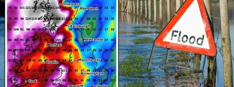
UK flood forecast: Britain put on ‘amber watch’ with 3 inches rain to batter country

BBC Weather: Heavy downpours to start the new week
We use your sign-up to provide content in ways you’ve consented to and to improve our understanding of you. This may include adverts from us and 3rd parties based on our understanding. You can unsubscribe at any time. More info
Jim Dale, Senior Meteorologist at British Weather Services said that the milder weather in March could cause large amounts of rain to fall across the UK. He warned that the UK could see up to three inches (76mm) of rain, which may lead to flooding as a result of water levels already being high. Speaking to Express.co.uk, he said: “The main preoccupation of the next week or so will be rain.
“Rain that will mount up over the next three days, across essentially south-west England, south Wales, maybe the south coast – Bournemouth way – into the South West Midlands, so Avon and upwards towards Worcestershire.
“That’s where we’re expecting the majority of the sustained rain to be over the period of this week.
“It’s a waving front – the air is being sucked up from the south.
“What that means for those areas is at least a couple or maybe even three inches of rain.


“Given the Severn is already high in the floods of last week, that’s a watchable event.
“So we’ve got it as an ‘amber watch’, which means a moderate watch on the capacity of what’s coming out.”
Mr Dale said that this kind of weather is typical for the start of Spring.
He said: “At this time of year, with meteorological Spring tomorrow, you do get a big capacity for the mixture of air.


“As you move from winter into Spring for the next to or three weeks, you get the mixture of the air streams – the colder air vs. the more temperate air, which can be even semi-tropical sometimes.
“So this air that’s coming up from the south is going to feel mild and it’s being dragged up from the south.
“It’s got the potential to contain a lot of moisture, to hold more water.
“And if it’s slow-moving, as this one is, it delivers a lot of water over a period of time.
DON’T MISS:
Households receive triple Cold Weather Payment of £75 as energy bills [INSIGHT]
BBC Weather: UK braces for 40mph gusts and heavy downpours [REPORT]
UK weather: Why this year’s weather season could have a dangerous edge [ANALYSIS]

“It’s not a 2-minute job, like big flash floods – this is a sustained rain event.
“So this is the time of year and then onwards from there when you get these air masses meeting.
“The comparison would be in the United States where you get the same kind of thing but on a bigger scale.
“When you get the tornadoes in the south. That’s the two air masses meeting when you get the colder dry air, vs. the moist warm air coming out of the Gulf of Mexico.
“In a very similar but diluted way, we get a similar sort of event over the next month, if not more.

“We talk about April showers, and there’s a good reason for it – those air masses create these big events.”
Weather forecaster WXCharts has predicted up to 3mm of rainfall per hour across Manchester, Edinburgh and central Scotland on Thursday.
In total, central Scotland will see up to 31mm of rain by the weekend.
Cardiff will see up to 38mm, while Birmingham will be hit with up to 28mm.
By the following weekend, rainfall will have reached up to 41mm in total in Birmingham, with 45mm in Manchester.
Source: Read Full Article
