Thousands of homes without power as severe thunderstorms roll into Melbourne

Thousands of Victorian homes are without power as massive thunderstorms roll into Melbourne from the northwest, bringing heavy rain and a risk of flooding.
Authorities have issued a warning for dangerous thunderstorms and intense rainfall for parts of central Victoria, including Melbourne, amid fears the front could cause life-threatening water surges.
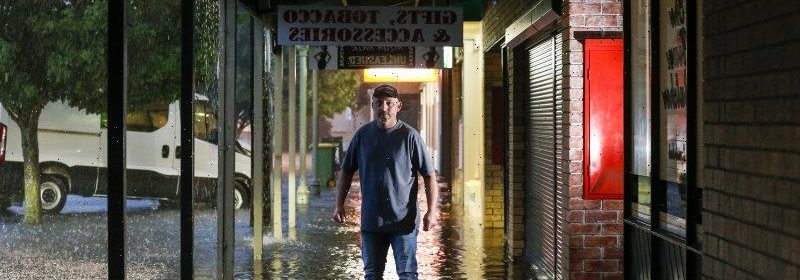
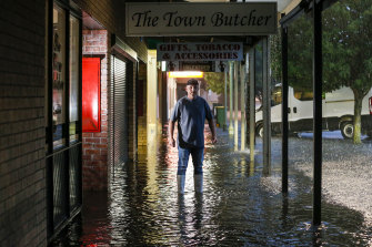
Butcher Chris Krstev looks on as floodwater inundates the shopping strip on Hamilton Street.Credit:Paul Rovere
Torrential rain battered Gisborne, in Melbourne’s northeast, just before 6am, flooding cafes and shops along Hamilton Street.
Butcher Chris Krstev, who was at his shop on the main retail strip when the downpour started, rushed to squeeze butcher coats under the door to prevent the water from coming in.
“It was torrential rain, just constant consistent rain,” he said.
“The water was lapping at our front door.”
Mr Krstev, whose butcher shop has nearly flooded three times in the past six years, said he was lucky to have been spared.
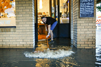
“The coffee shop on the corner, the water went through the front door and basically through the back door. It was just full of water, the whole floor, the whole shop,” he said.
Mr Krstev said the day had been saved by SES volunteers, who had arrived at the shopping strip about 7am to shovel mud and debris out of the blocked drains.
The Bureau of Meteorology said severe thunderstorms had been detected on the weather radar near Craigieburn, Footscray, Greensborough, Melton, Preston, St Albans and Sunbury just after 7am. The front had then moved to Greensborough and Ringwood, before tracking east.
The Corner cafe owner Saad El Amin sweeps floodwater out of his premises on the shopping strip on Hamilton Street in Gisborne.Credit:Paul Rovere
Forecasters predicted dangerous thunderstorms could hit Mr Dandenong, Yarra Junction and the area east of Mt Dandenong by 8.35am, moving towards Gembrook after 9am.
The heavy rainfall is likely to lead to flash flooding in Seymour, Melbourne, Wonthaggi, Frankston, Warragul and Mt Buller, prompting a warning from the State Emergency Services to avoid driving in floodwaters and seek shelter indoors away from windows. Dangerous and life-threatening surges are also forecast for Yarra Glen.
Several locations in Victoria have already recorded large rainfall readings, including Malmsbury Headwal where weather stations recorded 56.2 millimetres in the hour to 5.15am.
Springhill-Tylden Road received 23 millimetres of rain in the half an hour to 5.45pm while Trentham Reservoir experienced rainfalls of 38.6 millimetres between 5am and 6am.
As the front moved south, Arthurs Creek recorded 41.6 millimetres in the hour to 8.02am.
A severe thunderstorm warning was first put in place for parts of western Victoria, including Ouyen, Rainbow, Walpeup, Horsham, Warracknabeal, and Edenhope on Wednesday afternoon.
Its scope was expanded in the evening to include Port Phillip waters, Geelong and Bellarine Peninsula, with forecasters saying damaging winds and heavy rainfall were likely to hit Geelong, Werribee and the area south of Werribee just before 9pm, before sweeping south to Ocean Grove, the area north of Torquay and the area south of Geelong by 9.20 pm.
The storm front was preceded by a freak bout of rain at the Australian Open tournament at Melbourne Park about 5.30pm that brought games to a halt and forced administrators to close the roof on Rod Laver Arena as ball kids dried the lines with towels.
There were more than 5300 properties without power in Victoria’s west at 7.30pm on Wednesday due to the storms. That number was revised down to 3700 just before 10pm.
As of 7.30am on Thursday, more than 5000 households across the state were still off the grid, as the storm inched closer to Melbourne’s city centre.
The thunderstorms are the result of high levels of moisture in the air created by a tropical air mass from northern Australia, which has brought muggy weather conditions to Melbourne more akin to those in far north Queensland than Victoria.
The city sweltered through its hottest Australia Day in 16 years on Wednesday, with locals seeking reprieve from the heat in beaches, pools and waterways.
The storm front, which developed near the South Australian-Victorian border on Wednesday, is unlikely to offer relief from the hot and humid weather conditions, which will extend until Saturday.
A guide to the environment, what’s happening to it, what’s being done about it and what it means for the future. Sign up to our fortnightly Environment newsletter here.
Most Viewed in National
From our partners
Source: Read Full Article


