New weather maps show wall of snow to blanket UK in days

Weather: Met Office forecasts snow in the week ahead
We use your sign-up to provide content in ways you’ve consented to and to improve our understanding of you. This may include adverts from us and 3rd parties based on our understanding. You can unsubscribe at any time. More info
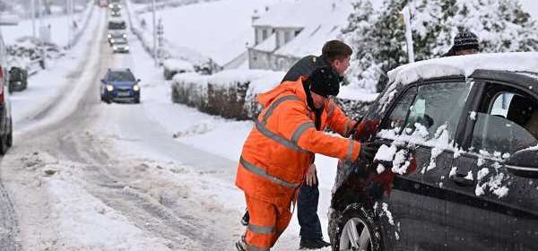
The UK will be swapping its recent mild weather for subzero conditions within days, according to the latest forecast. New weather maps from WxCharts show temperatures dropping as low as -11C in Scotland by next Thursday. This will also bring significant snowfall across the country with up to 21cm in the worst-hit areas.
The temperature drop is forecast to begin tomorrow evening and will last well into next week.
The freezing Arctic air will gradually sink down the country over the course of the week.
While Scotland will bear the brunt of the Arctic freeze and snow, around 5 centimetres of snow will blanket much of Wales as well as northern England and the Midlands.
The snow will cover most of these areas for days, according to the latest maps on WxCharts.
It is thought that London will avoid most of the snow, but temperatures in the capital will still plummet well below zero.
JUST IN: British-Iranian dual national Alireza Akbari executed in Iran


The imminent cold weather has prompted the Met Office to issue a level two cold weather alert for much of England from Sunday evening until Thursday morning.
The cold weather alert runs from 6pm on Sunday to 9am on Thursday across the North, the Midlands, and central and eastern parts of England.
The Met Office advises people in those regions to stock up on food and medicines to reduce the need to go outside.
London, the South, and South West are covered by a level one alert – warning people to stay vigilant.
Met Office forecasts rain as snow moves across Atlantic

Sky News weather presenter Kirsty McCabe said it would be getting “much colder” next week as a jet stream “plunges south, dragging cold air from the north across the UK”.
She warned that Britons should expect “significant wind chill” with “an increasing risk of winter hazards such as snow and ice”.
The Met Office warned about the incoming freeze, tweeting: “There’s a big change in store over the next few days.
“We lose the mild air that’s generally been coming in from the west for some time now, and tap into a colder northerly airstream.”
DON’T MISS:
Spare book review: Is Harry’s bombshell book actually any good? [REVIEW]
The NHS should no longer presume we will give it infinite cash [COMMENT]
State pension age increase rejected as ‘madness’ – YOU VOTED [POLL]

The Met Office’s Helen Caughey added: “After a spell of wet and mild weather to start 2023, a brief cold spell will change the feel of our weather across the UK for a few days next week.”
She said it will “certainly feel cold in all regions too, with the northerly winds creating a notable wind chill”.
This comes as more than two hundred flood warnings and alerts currently remain in place across the UK with western England and Wales the worst hit.
Severe flooding this week and heavy downpours have left roads and fields underwater and threatened homes.
The dramatic change in weather conditions also contrasts sharply with a remarkably mild start to the year, with temperatures in double digits across the country.
Source: Read Full Article
