Castle Rock just adopted a wildfire protection plan — but can it tame a Marshall fire-style burn?

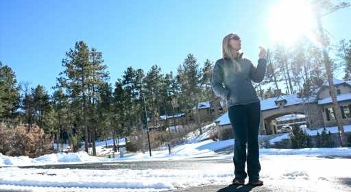
CASTLE ROCK — Meghan Diekmann’s home in an upscale neighborhood in this Douglas County town 30 miles south of Denver is shaded by stands of tall pines and surrounded by clusters of Gambel oak — a rafter of wild turkeys peck at the ground just feet from her front door.
The neighborhood, Pinon Soleil in north Castle Rock, is also designated as a “very high risk” wildfire hazard zone, according to a Community Wildfire Protection Plan adopted by town leaders last week.
“Flammable outbuildings, decks, projections, and fences,” as well as “decadent timber stands” and “natural and ornamental vegetation close to structures” are a threat to dozens of families living there, the plan states.
It’s a hazard rating that has taken on a sharper significance and gravity since a wildfire blazed through southern Boulder County less than a month ago, destroying nearly 1,100 homes and damaging another 149 — a catastrophe that many homeowners never thought possible in a suburban setting miles removed from the fire-prone foothills.
“You just need to be aware the danger exists,” Diekmann said, glancing out at late afternoon shadows cast by the ridges and promontories looming over her house. “On those windy days, I’ll be a lot more alert.”
Diekmann is not alone. Castle Rock’s wildfire protection plan, which has been in the works for several years but was only approved by the town council on Jan. 18, sliced the town of 80,000 residents and 24,000 homes into 19 zones. Seventeen of those zones were deemed “high” or “very high” risk for wildfire hazard while just two zones in town fell into the “moderate” risk category.
No parts of Castle Rock were considered at low or extreme risk.
Norris Croom, chief of the Castle Rock Fire and Rescue Department, said while the town’s new wildfire plan is critical to identifying danger spots, fuel loads and susceptible building materials — and hopefully getting ahead of fires once they ignite — there are certain weather and environmental conditions that can’t be corralled or restrained by even the most capable firefighting forces.
“When you throw in outside factors, specifically that day with a wind-driven (Marshall) fire, there’s not a lot you’re going to be able to do,” Croom said. “When Mother Nature decides that this is what she’s going to do, there’s not a lot we can do to stop that until she decides to settle down.”
He pointed to seven homes that burned in The Meadows neighborhood on the west side of Castle Rock nearly four years ago. In that case, a fire that started in one house was quickly pushed by wind to half a dozen others before firefighters were able to gain control.
But in a part of the Front Range that has seen its share of wildfires big and small over the last 20 years — The Hayman fire (2002), Cherokee Ranch (2003), Burning Tree (2011), Waldo Canyon (2012) and Black Forest (2013) — Croom said Castle Rock’s new wildfire protection plan will be helpful in pointing out ways to minimize damage from the overwhelming majority of burns.
“It’s to keep the typical wildland fire we see down here from becoming a major catastrophe,” he said. “This plan will help reduce the risk — it will not eliminate the risk.”
Aside from urging residents to create defensible space around their homes, in which trees and bushes near a structure are cut back to deprive a fire of fuel, Castle Rock’s plan talks about building homes out of ignition resistant materials and creating “linked defensible space,” or fire-resistant perimeters, around clusters of houses that have been built close together.
The plan, authored by Boulder-based wildland fire consultancy Anchor Point Group, also notes the challenge of keeping the town’s nearly 6,000 acres of parks and open space and 95 miles of trails from becoming a “highway for fire.”
“Development plans have encouraged open space islands between clusters of homes where natural fuels have been retained,” the plan states. “These factors have created a patchwork of islands and stringers of natural fuels occurring throughout the town limits.”
But those natural areas are a big part of Castle Rock’s attraction. Carol Reed’s home southeast of downtown backs up to Memmen Ridge Open Space and gets a “very high” risk rating from the town’s plan. A 43-year resident of the Glover neighborhood, Reed is well aware of the fire danger posed by the land behind her home, which the town’s wildfire protection plan describes as containing “heavy fuels” — specifically “oak brush fuel islands.”
“We’ve seen wildfires burn close enough that we could see the orange glow on the horizon,” Reed said. “I still feel pretty safe here.”
But she said there’s no doubt that the Marshall fire 50 miles north has brought her and her neighbors a “heightened awareness” that they may not be as safe as they thought they were.
Town Councilwoman Caryn Johnson calls the Marshall fire a “wake-up call” for Castle Rock. She says one of the biggest challenges for the fast-growing town is to achieve a balance between the inspiration and awe the open and rolling landscape around town gives residents and visitors and the fatal potential that same land possesses should it ever go up in flames.
“Finding that balance is hard but we hope to find something that will keep Castle Rock looking the way it does with open space and keeping our residents safe,” she said.
Source: Read Full Article

